Not on display
- Artist
- Layla Curtis born 1975
- Medium
- 2 lithographs on paper mounted onto foam core on hardboard
- Dimensions
- Unconfirmed: 2050 × 2260 mm
- Collection
- Tate
- Acquisition
- Purchased 2000
- Reference
- T07596
Summary
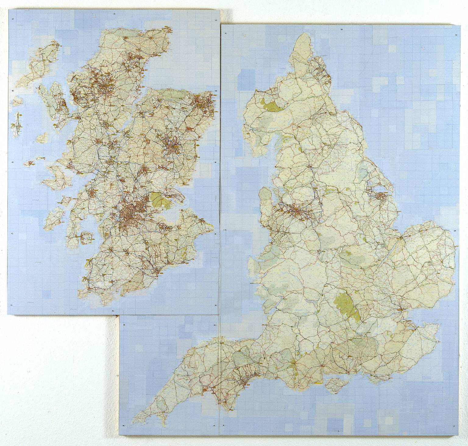
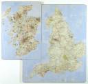
United Kingdom is a large collage consisting of an altered version of the road map of the United Kingdom. It is made up of small squares, cut from commercially produced road atlases, and stuck onto two abutting rectangular panels. The larger panel, on the right, contains the outline of England. The outline of Scotland, cut away from England, has been shifted to the position normally occupied by Ireland, to the left of England and Wales. It is on a smaller panel which is inserted into an area cut out of the left side of the larger panel. The panels are protected by sheets of Perspex, which are attached to the backing with visible steel screws. Curtis has exchanged the Scottish, English, Northern Irish and Welsh road systems, so that Scottish, Northern Irish and Welsh roads, cities and towns are redistributed within the English border and English, Northern Irish and Welsh roads, cities and towns now appear within the Scottish landmass. Through her transformation, formerly coastal towns have become landlocked, cities far from the sea have become coastal destinations and some names designate more than one location. The collage has been carefully designed so that roads appear continuous and navigable, conferring authority on the map. Plausible at first glance, its disorientating systems question the logic of geographic infrastructures, place names and political unions. Curtis has said: ‘Travelling has always been an integral part of my life. Like most people I rely on and trust maps to find my way, locate myself and plan journeys. By dissecting, dismembering and collaging maps to create new, hybrid maps, I aim to explore the effects of disturbing this trusted system of mapping.’ (Quoted in The Map is Not the Territory, p.9.)
Curtis graduated from Edinburgh College of Art, where she was studying painting, in 1998. She then went to Japan to take up a year’s residency at the newly created Akiyoshidai International Arts Village (Yamaguchi Prefecture) where she took part in an open studio programme and held her first solo exhibition, Mapping. Her work during this period involved cutting up, reassembling and collaging Japanese road maps. United Kingdom had been researched in Edinburgh, during the recent period of Scottish political devolution from England, and was completed in Japan. It is the first of several works based on the contours of the United Kingdom. These include The United Kingdom of Japan 1999 (private collection), a collage of Japanese maps made in Japan. The United European Union 1999 (Collection Fondation Salomon, Alex, France) was created from maps of European Union countries on Curtis’s return to Britain to study an MA at Chelsea College of Art, London (graduated 2000). Such subsequent works as The United Kingdom of America 2000 (private collection, courtesy Rhodes + Mann, London) examine the etymology of place names as a result of settlement and colonisation. This work highlights the transfer of Old World names to the territory of the New World, restaging it through collage. With her World Political Wall Map 2000 (private collection, courtesy Rhodes + Mann, London) Curtis shifted many countries around within the contours of the continents, creating a convincing new geography. Embroidered world maps created between 1969 and 1993 by Italian artist Alighiero Boetti (1940-94) draw attention to changing political boundaries. In a similar manner, by cutting up and reassembling maps to create believable new entities, Curtis demonstrates the artificiality of political boundaries and the national identities created by them. Like Simon Patterson’s print of a map of the London Underground, The Great Bear 1992 (Tate P77880), Curtis’s rearranged maps expose the arbitrary and often incongruous nature of place names.
Further reading:
The Map is Not the Territory, exhibition catalogue, England & Co, London 2001, pp.9–10.
New Contemporaries 99, exhibition catalogue, Exchange Flags, Liverpool and South London Gallery 1999, pp.28–9.
P. Usherwood, ‘Alison Turnbull, Layla Curtis, Richard Wright: Milton Keynes Gallery’, Art Monthly, no.240, October 2000, pp.38–9.
Elizabeth Manchester
January 2003
Does this text contain inaccurate information or language that you feel we should improve or change? We would like to hear from you.
Display caption
United Kingdom was made during the period of Scottish political devolution and the establishment of a Scottish parliament. By manipulating a road map of Great Britain, Curtis integrates Scottish and Welsh territory within the contours of England, and English and Welsh within Scotland. Furthermore, Scotland has become a separate island, occupying the position usually held by Ireland. By imposing the details of one geographical area upon the outline of another, Curtis raises fundamental questions about place and national identity.
Gallery label, November 2006
Does this text contain inaccurate information or language that you feel we should improve or change? We would like to hear from you.
Explore
- emotions, concepts and ideas(16,416)
-
- formal qualities(12,454)
-
- fragmentation(233)
- UK countries and regions(24,355)
-
- Great Britain(113)
- social comment(6,584)
-
- nationalism(2,020)
- inscriptions(6,664)
-
- map(56)
You might like
-

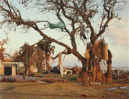
Mitch Epstein Biloxi, Mississippi 2005
2005 -
Emma Kay The Bible from Memory
1997 -

Richard Hamilton Typo/Topography of Marcel Duchamp’s Large Glass
2003 -
Gilbert & George Death Hope Life Fear
1984 -
Hamish Fulton Arkle Sutherland
1976 -

Li Yuan-chia Untitled
1993 -
Li Yuan-chia Untitled
1993 -
Tracey Emin Monument Valley (Grand Scale)
1995–7 -
Richard Long CBE Waterlines
2003 -

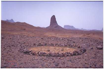
Richard Long CBE Sahara Circle
1988 -
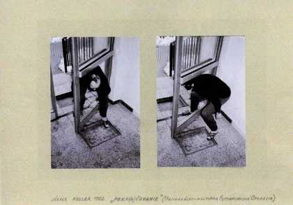
Július Koller Continuation/Stoop (Universal-Cultural Futurological Operation)
1982 -
Július Koller Universal Fantastic Orientation 1-6 (U.F.O.)
1978 -
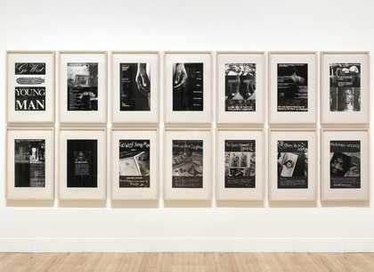
Keith Piper Go West Young Man
1987